
The Role Of Space Technology In Climate Change Monitoring And Environmental Conservation
Space technology has quietly changed the game in how we track climate change and protect the environment. With satellites circling the Earth around the clock, data is now collected faster and more accurately than ever before. For people interested in climate science or environmental action, understanding the role of space technology can really boost awareness and support more informed decisions. Here, I’m sharing an all-in-one look at how satellites and other space tech are powering climate monitoring and conservation work around the globe.
Why Space Tech Matters for Earth’s Climate and Environment
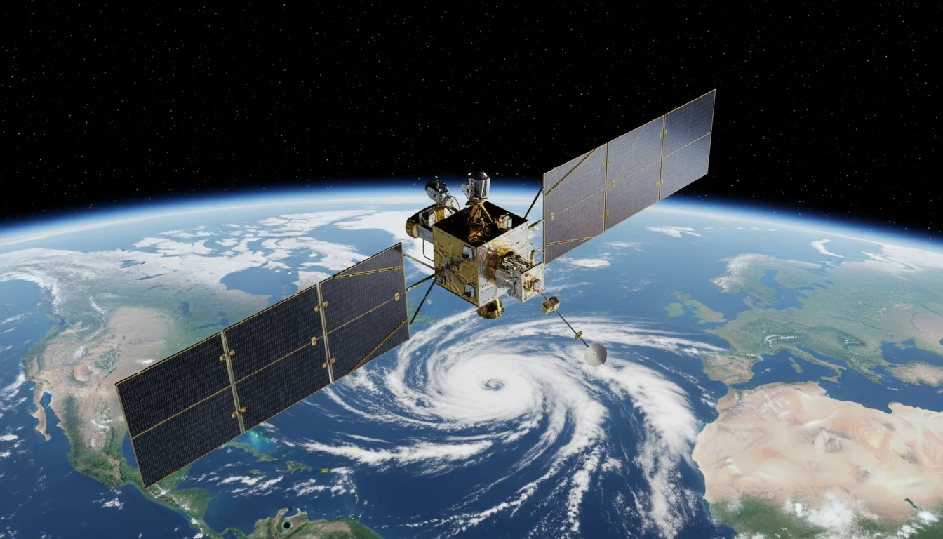
Satellites and other spacebased tools are a big part of how scientists track the condition of our planet. Gathering ground data alone used to take weeks, and some remote places were just out of reach. Satellites now provide global snapshots and detailed measurements of things like ocean temperature, glacial melt, and forest coverage in real time. The space industry hasn’t just grown in size; it has changed how researchers, governments, and organizations understand and respond to climate issues.
The impact of space tech goes beyond just the raw data. Agencies like NASA and the European Space Agency (ESA) openly share satellite data, making it accessible not only to scientists but also to teachers, students, and policymakers. Space observation programs, such as NASA’s Earth Observing System and ESA’s Copernicus, send back terabytes of data every day, giving everyone a much clearer view of what’s happening across the globe.
The timeline is interesting, too. Space tech used to focus almost entirely on launching astronauts or exploring planets. Now, a huge focus is on protecting Earth; our only home. These efforts support both quick emergency response and longterm environmental planning.
As climate change speeds up, the ability to monitor shifts in real time is crucial. For example, during large wildfires or rapid ice melt, satellite images offer updates that can literally save lives and ecosystems. The reach of space tech means we’re not just limited to places with clear roads or where researchers can go on foot; space-based eyes can spot trends and small changes all over the globe, from the dense Amazon rainforest to the frozen Arctic.
Get Started or How Space Tech Tracks Climate Change
Understanding what these satellites actually do can make it easier to follow climate stories in the news or take part in local conservation projects. Here are some key systems and terms that come up a lot:
- Earth Observation Satellites: These orbit the planet, taking images and measurements day and night. Some focus on land, others on oceans, clouds, or even atmospheric gases.
- Remote Sensing Instruments: Tools like radar, LIDAR, and spectrometers measure things like carbon dioxide, heat, or the thickness of ice sheets from space.
- Geospatial Mapping: Space data feeds into detailed maps, which help researchers track wildfires, floods, deforestation, and more.
For those starting to follow these topics, you’ll notice satellite missions have names like Landsat, Sentinel, or Terra. Each has a different specialty; some track plant growth, others focus on atmosphere quality or ocean circulation. The science can seem complex, but the takeaway is simple: accurate, frequent, and global data are now the bedrock of climate science.
Besides the big government-run missions, there are also private companies launching satellites. This means there’s more data than ever. While some of it is available for a fee, many public records are still free and up-to-date, making them super useful for education or citizen science projects.
Steps to Using Space Tech Data for the Environment
Anyone curious about how this tech translates into realworld actions (or looking to use satellite data themselves) will find these general steps helpful:
- Identify the Data You Need: Want to see how forests are changing or how sea ice is retreating? The major space agencies offer searchable databases online, like NASA’s Earthdata or the Copernicus Open Access Hub.
- Download and Visualize the Data: Most climate maps and remotesensing images can be accessed through free platforms. Tools like Google Earth Engine allow users to run quick analyses or just browse timelapse changes right from a browser.
- Compare and Cross-Reference: Combining satellite images with historical maps, weather reports, or ontheground surveys reveals what’s changing fastest and where.
- Share or Publish Insights: Datasets, images, or even timelapse videos can help start local conservation efforts or raise awareness in schools, local communities, or online platforms.
You don’t need a science degree to get value from this tech. Many researchers, journalists, and grassroots groups use freely available imagery to track illegal logging, wildlife loss, or even trends in crop health.
In addition, educational resources and open-source courses have grown rapidly, so beginners are not left out. Many websites provide step-by-step guides and video tutorials for those wanting to learn how to process, interpret, and make the most of the vast datasets from space. Online communities centered around climate data often share tips, tricks, and insights on using these platforms for various environmental goals.
Things Worth Thinking About Before Relying on Space Tech
As with any technology, spacebased data has some challenges. Here’s what to keep an eye out for and some ways to handle these sticking points:
- Resolution (Clarity) Limits: Some satellites capture images that are sharp enough to spot cars, but most only resolve features down to a few meters or more. For projects needing ultra-detailed info, you’ll need to source the right data or combine it with local sampling.
- Data Processing: Raw satellite data isn’t immediately readable; it often needs to be corrected and processed. Luckily, there’s a growing number of userfriendly web platforms that help handle this automatically, no coding needed.
- Cloud Cover: Regular satellites can’t see through clouds. Radar-based satellites, like ESA’s Sentinel1, fill in this gap, but are better at some jobs (like tracking flooding or ground movement) than others.
- Costs and Licensing: Many datasets are free for public or research use, but some commercial images or complex analyses require paid licenses. It pays to start with public archives or openaccess portals before reaching out to private companies.
Resolution Challenges
For most environmental uses, like checking tree growth or mapping a river’s path, the standard resolution is fine. But if the goal involves tracking small patches or individual animals, drones or local sensors might work better together with satellite data. Mixing local and spacebased info is a great way to fill in the gaps.
Understand Data Formats
Downloaded satellite files might come as something called GeoTIFF, NetCDF, or HDF. While these sound intimidating, free viewers and online tutorials are available, so even beginners can pick up the basics within a few tries. The more you play around with these tools, the easier it becomes.
Weather and Atmospheric Issues
Many Earth observation satellites orbit above the clouds, but their cameras are blocked by weather just like planes can be. That’s why pairing optical satellites with radar or other bands of observation is pretty handy for getting a more complete picture.
Data Access and Privacy
Most climate and environmental satellite data are openly available, but not all. Some highresolution images are locked behind paywalls. It’s always good to make sure the data you’re using matches your needs and doesn’t require special licensing for public sharing.
Even with these bumps, space technology is making the science of tracking climate and the environment way more accessible and reliable. The more you use it, the sharper your insights become.
Smart Uses of Space Tech in Conservation
When you look at real world examples, it gets clear how big a difference this tech makes. Here are a few ways people use it on the ground:
- Forest Watch: Projects like Global Forest Watch use satellite images to alert authorities when new trees are being cleared, almost in real time. That’s a big step up from depending only on forest rangers.
- Disaster Response: During hurricanes, floods, or wildfires, satellites help emergency planners quickly spot the worst-hit zones and plan relief work. This info can be the main source for safety maps and evacuation alerts.
- Wildlife Monitoring: Tracking grasslands, deserts, or remote islands helps scientists spot trends in animal populations or habitats under threat, guiding where to send drones, rangers, or biologists on the ground.
In addition, conservationists working to protect endangered species can get a boost by locating hard-to-find nesting sites or monitoring migration patterns, often in near real-time. By integrating satellite data with ground patrols, conservation groups can allocate their resources more efficiently, prioritize hotspots, and even prevent poaching or illegal activities before they spiral out of control.
Frequently Asked Questions
People often ask how they can get involved, where to find reliable information, or how accurate these tools really are. Here are some answers to the most common questions:
Question: How do I access satellite data for climate monitoring?
Answer: Most major agencies, like NASA or ESA, provide public-access databases. NASA’s Earthdata Search or ESA’s Copernicus hub are good places to start, even for those new to the topic.
Question: Is satellite data really accurate for climate science?
Answer: Yes, the accuracy is high for largescale measurements like temperature, land cover, or ocean monitoring. Local verification is sometimes needed, especially for more detailed studies.
Question: What are some ways space tech supports environmental conservation efforts?
Answer: Satellites monitor deforestation, track illegal mining or fishing, map habitats, and help direct quick action during natural disasters; all things that used to take much longer to confirm.
Question: I don’t have technical skills. Can I still use satellite data?
Answer: Absolutely. Many platforms are userfriendly and designed for community use, with plenty of tutorials available online. You can start exploring basic data and maps without prior experience. Community projects and open science platforms also offer collaboration opportunities for beginners.
Question: How can space tech contribute to climate education?
Answer: Space tech brings eye-catching graphics, realtime animations, and timelapse videos into the classroom. Teachers can use satellite maps to show students changing landscapes, shrinking glaciers, or expanding cities, making abstract climate concepts visually engaging and easier to understand.
The Impact of Space Technology on Climate and Conservation
Space technology has really opened new doors for understanding climate change and driving conservation efforts. From spotting illegal logging to predicting storms or guiding wildlife protection, these tools make the work faster, smarter, and much more global. Getting familiar with how satellites and sensors work gives anyone the edge when following environmental news or starting a project of their own. Space tech offers a new perspective, giving us a true bird’seye view and helping protect the planet for future generations. As technology keeps advancing, even more creative ways to protect our environment from above are sure to show up. So next time you see a stunning satellite image of Earth, remember—those eyes in the sky are working around the clock to help keep our world safe.
Make your own inventive corner
Ready to start your own website and share your passion with the world? Join me and unlock step-by-step training to build your online presence just like I did! Use my links if you want me as your coach!